Giglio Test Experiment
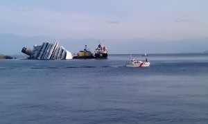
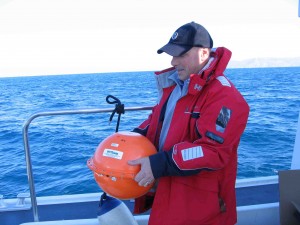
On February 14, 2012 at 9:00, four drifting buoys were deployed by PNAT close to the Costa Concordia accident to test the operational aspects of the buoys and their ability to supply real position in case of oil spill accident, and also to certify the prediction skill of a numerical model realized by CIMA/Ualg.
The numerical model was run at the same time of the deployment with the most updated meteorological and current information.
The buoys were deployed successively with a linear arrangement from northeast to southwest and an average distance of about 7km between Giglio and Giannutri Island.
Meanwhile, all the data collected from:
– drifting buoys,
– satellite of General Command of the Coast Guard,
– AIS from various sources such as web aggregators (i.e. Marine traffic, AISHub) and General Command of the Coast Guard,
– static oceanographic buoys one located near Giglio, the other near Gorgona, for meteorological data and forecast purposes,
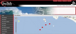
were real-time inserted by ISTI/CNR and made available on-line on the ARGOMARINE Marine Information System together with a simulation of oil-spillage from the Concordia ship, provided by CIMA partner. Finally, a dynamic risk map of oil-spill accident was also generated, integrated and visualized for the whole PNAT area.
The four drifting buoys were recollected on February 15, from 9.00 to 12.00 am by PNAT.
The buoys were deployed without difficulty, all worked and transmitted data to the system. The recovery of the buoys was also easy and without incidents.
The results of the test were globally very positive:
the whole information system realized by ISTI-CNR is functioning and able to connect, retrieve and integrate the available data, reasonable agreement was obtained between buoy and predicted by CIMA trajectory patterns. The major discrepancies allowed us to identify the limitations of the forcing data, namely the wind data coming from regional meteorological models, without sufficient resolution to include the effects of the islands.
the whole information system realized by ISTI-CNR is functioning and able to connect, retrieve and integrate the available data, reasonable agreement was obtained between buoy and predicted by CIMA trajectory patterns. The major discrepancies allowed us to identify the limitations of the forcing data, namely the wind data coming from regional meteorological models, without sufficient resolution to include the effects of the islands.
Next Steps:
CIMA efforts are now being put on trying to numerically cope with these small inaccuracies, in order to find a modeling strategy to get the best reproduction possible of the buoys track, and consequently the oil spills that may be simulated in the future.
PNAT will organize another field experiment, planned in spring 2012 at Elba Island, that will ensure a full connectivity of all the components of the ARGOMARINE Marine Information System that thus will be capable to manage all the remote data and ensure real-time reaction, with the aim of performing a near-real-time emergency intervention support.
Category: News


